BIRCHOVER gets its name from references to the birch tree. There are records of the village name being spelt as Barcouere and Birchoure with the modern spelling being recorded in 1265. All of the names refer to a ‘ridge overgrown with birch trees’.
The earliest settlement was originally located at what is now known as Uppertown, about half a mile south and slightly higher up the hill than the modern-day village of Birchover.
ROWTOR ROCKS at Birchover was explained to Victorian sightseers as an ancient Druid stronghold but the only local connection with Druids was the Druid Inn which was a meeting place for the Ancient Order of Druids, a friendly society founded in 1781.
Carved in and through the gritstone of Rowtor Rocks are caves, rooms, alcoves, tunnels, flights of worn stone steps, a stone armchair, a square font, cup and ring markings, rock basins and square sockets which may have supported crosses.
The views are now obscured by trees but nevertheless still impressive.
All of this extensive sculpting was the work of local parson Thomas Eyre three centuries ago.
At the eastern edge of the eighty yard gritstone ridge was a large rocking stone, weighing an estimated 50 tons, which could be moved by hand until, it is said that on Whit Sunday 1799 a gang of 14 young people pushed the stone off its pivot. The stone was replaced but the original balance could not be restored.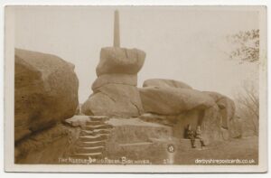
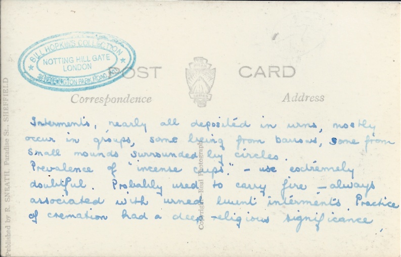
Stanton moor near Birchover is a complex of prehistoric sites. Most recognised is Nine Ladies Stone Circle, a small early Bronze Age stone circle traditionally believed to depict nine ladies turned to stone as a penalty for dancing on Sunday.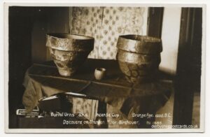
from Wikipedia –
“There are nine upright stones, each of local millstone grit, each less than a metre high, in a clearing in a modern wood planted on Stanton Moor. They sit in a rough circle with a gap at the south side of the circle where no stone-hole has been found. However, an additional stone, lying flat rather than upright, was discovered after being exposed as a crop mark in the dry weather of 1976. It is now visible. The circle is built on an embankment which levelled the local terrain. The small “King Stone” lies forty metres from the circle to the west-south-west and is clearly visible from it.
The Nine Ladies were among the 28 archetypal monuments in England and Wales included in General Pitt-Rivers’ Schedule to the first Ancient Monuments Protection Act, which became law in 1882. It was taken into state care the following year”
 from Wikipedia –
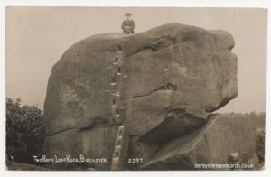
The Andle Stone is a large gritstone boulder on Stanton Moor in Derbyshire. The stone block is 6m long, 4m high and lies within a low, circular, dry stone wall enclosure. It is covered in cup and ring marks. It is also known as the Oundle Stone, the Anvil Stone or the Twopenny Loaf.
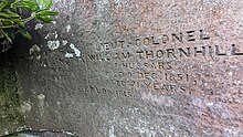
There is a memorial inscription on the west-facing concave face of the boulder, commemorating the Duke of Wellington, Lieutenant Colonel William Thornhill (2nd son of Bache Thornhill of Stanton Hall[3]) and the battles of Assaye and Waterloo. The inscription reads:
|
FIELD-MARSHALL
DUKE OF WELLINGTON
DIED 14 SEPT 1852
AGED 82 YEARS
|
LIEUT-COLONEL
WILLIAM THORNHILL
7 HUSSARS
DIED 9 DEC 1851
AGED 71 YEARS
|
|
|
ASSYE 1803 WATERLOO 1815
|
||
The Andle Stone and the nearby Doll Tor stone circle are both on private farmland with no public access rights.


