Derby

from Derby City Guide
The first human settlement of Derby was by the Romans who built a fort on high ground around Belper Road, overlooking the river Derwent, one of a line of forts seeking to protect the first boundary of their newly conquered province.
Soon realising the importance of the area, around AD80, they moved across the Derwent and built a new fort on the east side calling it Derventio. Gradually a civil settlement grew up around the camp and in the 1970’s an industrial suburb of Deventio was discovered on Derby Racecourse, consisting of a 25ft wide road lined with timber buildings, 2 pottery kilns and a cemetery.
The great Roman Road of Rykneld Street connected the garrisons of the wild north with the civilised Roman towns of the south, passed straight through Derventio.
The Romans stayed for over three centuries until the great withdrawal in an attempt to save Rome from the barbarians.
A hundred years later the Saxons arrived in strength, sailing up the river Trent and completing their colonisation of this island. They renamed the Roman fort Little Chester, the name by which it is still known today, and built a village a mile to the south of it which they called Northworthy, with a seperate development growing up and around St Werburghs Church.
This area was ideal with Markeaton Brook providing the water supply. A saxon called Walda started a dairy farm and Walde’s Wick, later becoming the Wardwick, was a Saxon Street joining the farm to Northworthy. A town was slowly beginning to form. Many of Derby’s suburbs owe their present names to the Saxons who enjoyed 300 years of uninterupted rule until the coming of the Danes who captured Nottingham in AD868.
Soon after, Northworthy and much of the rest of the region was taken. Northworthy was renamed Derby and the town expanded, having a population of about 1200 in AD874.
By 917AD the Anglo Saxons under Ethelfleda, Lady of the Mercians and King Alfred’s daughter had won back the town. Under the Danes it had become one of the 5 Danish Boroughs along with Nottingham, Lincoln, Leicster and Stamford. These were the military, administrative and commercial centres for the respective surrounding areas all of which became shires by the late 10th or early 11th century. Eventually a sort of uneasy peace developed between the Waring factions. By the time of the Domesday survey, the population had fallen. In Domesday it appears that ‘Derby was a self contained agricultural community grinding it’s own corn, fattening it’s own livestock, shaping its own crude farm implements, weaving it’s own cloth and even catching it’s own fish from the Derwent and eels from Sinfin’.
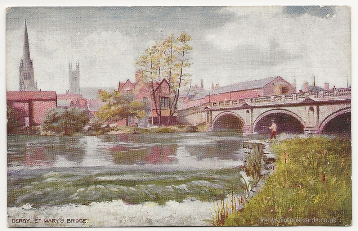
Six churches are mentioned in Domesday as belonging to the region. They were All Saints, which became Derby Cathedral in 1927, St Alkmunds, which was probably the first one built, but demolished in the late 20C to build a road, St Michaels, St Peters, St Werburghs and St Marys.
By the early part of the 13th century the Market Place was known to have been a busy commercial centre with shops and stalls and first street names appear. Newland Street from around 1190, St James Lane, now Street and Sadler Gate appear about 1250. Walker Lane in 1263, St Mary’s Gate in 1265 and Full Street in 1280.